Hunting Ridge
Baltimore City Ordinance 03-1186 11/03/03
Description
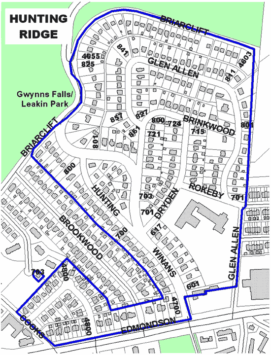
 The Hunting Ridge Historic District is centered around Winans Way. The District is bounded on the north by Briarclift Road, which intersects Winans Way and bounded on the south by Edmondson Avenue. The western boundary is Hunting Place/Winans Way and the eastern boundary is Glen Allen Drive. Though primarily a residential area, the Edmondson Village Shopping Center was a major point in residential life. Businesses in the area included Anderson Foreign and Sports Cars dealership. Residential architecture in the district includes the Tudor, French Eclectic, Spanish Mission Revival, Colonial Revival and Cape Cod Colonial styles.
Significance
The Hunting Ridge Historic District originally encompassed what is now Edmondson Heights, Rognel Heights, Ten Hills, Uplands and perhaps as far west as Rolling Road. The land for the District was originally owned by John Scutt in 1695. Scutt would eventually lose his land, having pieces bought up by such notable persons like John Bailey, Daniel Dulany, Benjamin Tasker, John Swan, Bernard Baker and John Cook. Once marked by large mansions and open expanses of land, the District today is a blend of several different styles of architecture. Not only does each home have its own unique style, many homes are themselves blends of different styles. The architectural styles add to the overall aesthetic and historical value of the District.