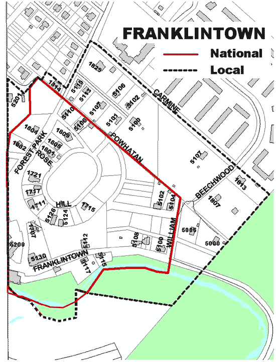
Franklintown
Baltimore City Historic District Ordinance 98-869 06/09/98
National Register of Historic Places 11/11/01
Description
 The Franklintown Historic District consists of three main components: the Franklintown Mill and its buildings, Freeman's Oval, and the original Franklintown commercial area. Each is distinct, yet the three components combine to form a unique historic district. The mill and related buildings are constructed primarily of fieldstone. The construction date of the first half of the nineteen-century but may be even earlier. The two-story mill was renovated into a private home in 1950s and the wheel is no longer present, yet it retains architectural characteristics that are common in gristmills in the Baltimore City and Baltimore County region.
Set close to Franklintown Road, the mill is located on the banks of Dead Run, which provided its power source, and the building's position along the stream banks is a critical part of integrity of this area of the proposed district. Located across Franklintown Road from the mill is a large, fieldstone, mill warehouse. Originally used for various purposes, the warehouse shares an architectural character with the mill building. Other fieldstone and frame residences are located along Franklintown Road. All have rectangular footprints and are two stories with side-gable roof forms. While some of these residences have additions, their overall integrity is not compromised.
The wooded surroundings of the Gwynns Falls Park also add to the integrity of the site, which retains it original setting and feeling. Few grist mills high degree of integrity remain in Baltimore City. Unlike textile mills, for example, which require many workers, gristmills required few employees, depending heavily on the skilled miller himself. Therefore, there were nor numerous associated workers' dwellings such as those found in the historic village of Woodberry, a former textile mill town in Baltimore City.
Significance
The Franklintown Historic District meets National Register Criterion C. Under Criterion C, Franklintown's plan as a resort community or suburb appears to be unique, The 1832 date appears to be a key factor in its significance, as few resorts or suburbs have been documented at this early date in this country's planning history, and William Freeman's design of an oval park radiating, wedge-shaped lots cannot be shown to be influenced by or derived from any similar known plans. Franklintown capitalizes on a combination of elements that made it desirable place to live and visit in the early years old its inception and establishment. Its location outside of the industrial areas of Baltimore, its proximity to the Franklin Turnpike, and its use of elements of the Picturesque Movement all contribute to the high artistic value of Freeman's plan.
The architectural elements of Franklintown qualify as a significant and distinguishable entity whose components lack individual distinction. The majority of the modest vernacular buildings which comprise Franklintown as a collection convey the intent of Freeman's plan and the era of Franklintown's establishment as a rural village. The key residential building are excellent examples of the I-house form and display steeply pitched cross gables found in vernacular rural buildings throughout much of Maryland. The pivotal commercial buildings such as the Franklintown Inn continue to display Freeman's intent of providing amenities to the residents of Franklintown. The collection of mill buildings is also impressive for the high degree if integrity they display. They continue to articulate their original purpose and appear to be a rare group of buildings within the present-day boundaries of Baltimore City.